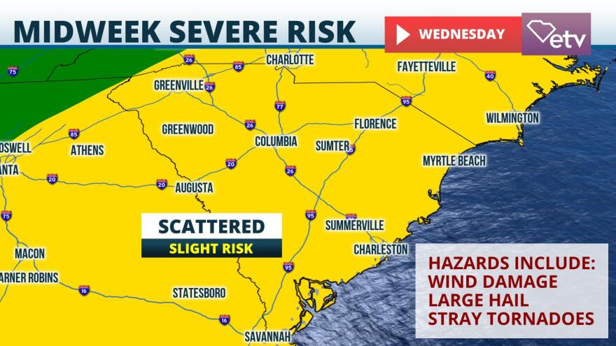
A powerful cold front will push through South Carolina during the midweek period and it could bring the risk of severe weather.
Surface observations Monday afternoon depict an area of low pressure developing on the lee side of the Rockies in Colorado, with a warm front stretched from North Texas to Houston. Through Tuesday, this frontal system will bring the risk for severe weather from East Texas to the Gulf Coast. The area of low pressure is forecast to move into the Upper Midwest Wednesday, with a warm front expected to lift north across the Carolinas. This will set the stage for increasing dew point temperatures and growing instability in the Palmetto State ahead of the cold front.
Model guidance suggests a broken line of storms enter the Upstate early Wednesday. This line will push east through the day as a warm front lifts through the state. There are still questions regarding the coverage and intensity of thunderstorms, as timing differences can have a large impact on severe threat. Storms that arrive early in the day will not have as much heating-driven instability to feed on. Despite this, the Storm Prediction Center has much of South Carolina under a "slight" risk for severe weather Wednesday, which is a two on a one-to-five scale. This designation means that a few thunderstorms may be severe, with the risk of damaging winds and large hail. As the warm front lifts north through the day Wednesday, there is also the risk of a few tornadoes, especially south and east of I-85 where greater instability may be realized.
There are still approximately two days for more clear details to be realized from weather models, so South Carolinians are encouraged to keep an eye to the forecast. Ahead of severe weather, it is important to know severe weather terminology. A "watch" means that conditions are favorable for severe weather. A "warning" means that severe weather is imminent or occurring and you need to seek safe shelter immediately


