
-
 City of Myrtle BeachSouth Carolina officially entered astronomical summer on June 21, marking the longest day of the year.
 -
 Tropical Storm Arthur was short-lived, but its leftover moisture brought heavy rain, gusty winds, and isolated severe weather to parts of South Carolina.


-
 Colorado State lowers its 2026 Hurricane Season forecast due to a strong El Niño developing during the season. What does this mean?
 -
 Since reliable global temperature records began in the 1950s, Earth's warmest years have occurred during El Niño events, while the coolest years have typically coincided with La Niña conditions.
 -
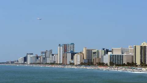
 South Carolina's deadliest weather threat may not come from the sky at all. Rip currents are the leading weather-related killer along the Carolina coast, and some of the highest-risk days happen when the weather looks beautiful.
 -
 Front slides in tonight through South Carolina. Temperatures drop slightly, then ehat ramps up. Winds will shift.
 -
 Wildfire activity is expected to remain near normal levels this summer across South Carolina following a significant amount of rainfall during May.
 -
 In South Carolina, a tropical system can begin as a coastal threat and quickly turn into an inland flood disaster. Heavy rainfall, swollen rivers, blocked highways, and tree damage often become the defining impacts well away from the beach.
 -
 South Carolina has seen just three June tropical cyclone landfalls since 1851, with no system stronger than a Category 1 hurricane.
 -
 In South Carolina, hurricane risk is not confined to the coast. Storms can bring surge, tornadoes, blocked roads, major outages, and infrastructure damage far inland, making statewide impacts a major part of the story.
 -
 During an average year, the Atlantic Basin sees 14 named storms, seven hurricanes and three major hurricanes. The list of names for the 2026 Atlantic hurricane season starts with Arthur.
 -
 A weather pattern change, which resulted in many communities seeing at least half a foot of rain during May, has led to improvement in the drought conditions.


