

Severe thunderstorms with a threat of damaging winds and isolated tornadoes will persist through the mid-late afternoon on Wednesday. Currently, dangerous storms are tracking through central South Carolina this morning and will head into eastern parts of the state early-mid afternoon.
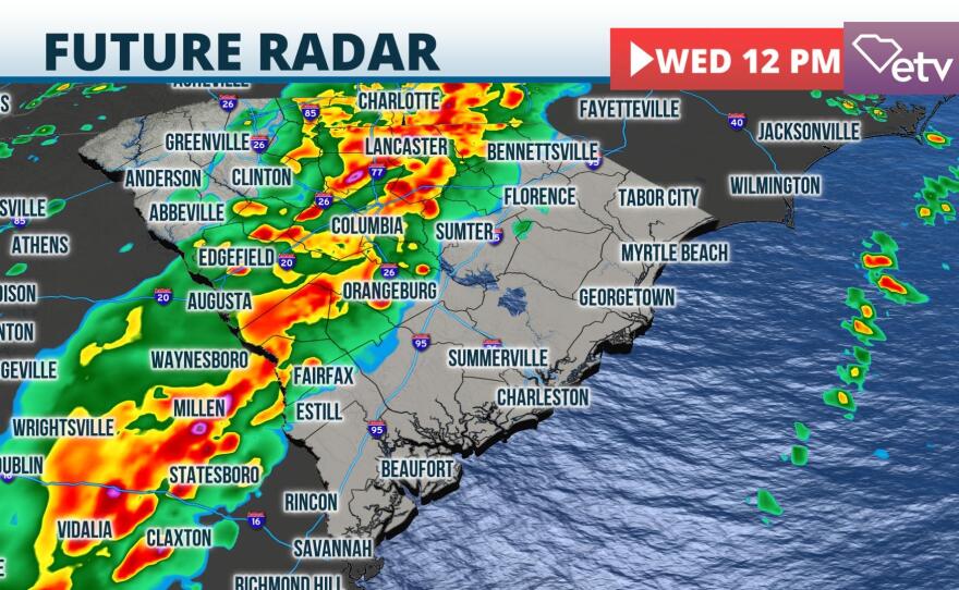

A Tornado Watch is in effect until 2 p.m., but that may get extended if storms maintain intensity as expected. The National Weather Service in Columbia report a tornado likely touched down near Red Bank around 10:45 a.m. There are additional scattered reports of damage across the area.

If storms move into your neighborhood, please seek shelter immediately and stay away from the windows. Head to the lowest floor of your building. The severe threat should be offshore between 4 and 6 p.m. today.