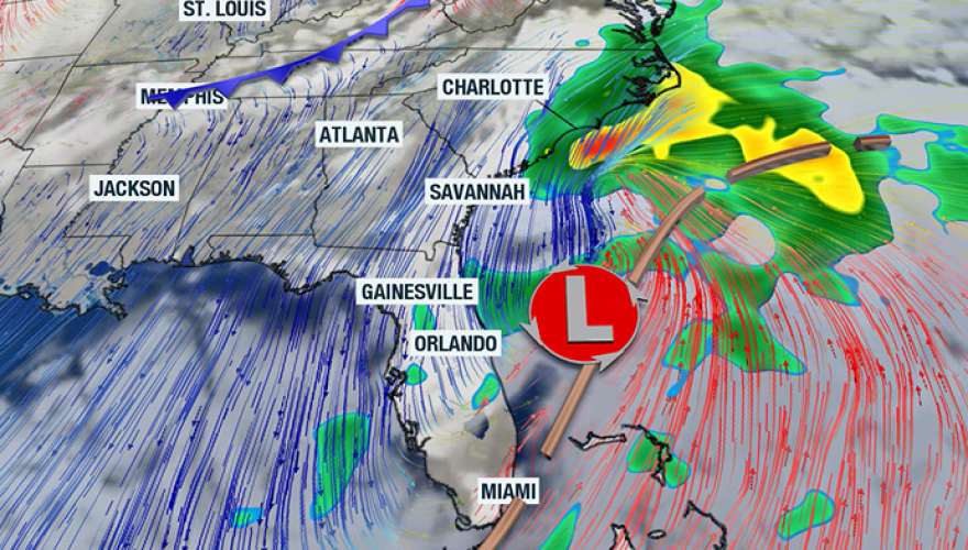
A developing nor’easter will keep hazardous conditions in place along the Southeast coast through the weekend, bringing the likelihood of gusty winds, coastal flooding, high surf and dangerous rip currents.
Forecast models indicate that most of the precipitation associated with the storm will remain offshore, but parts of the Grand Strand could still see rainfall totals of up to an inch by the time the system moves away.
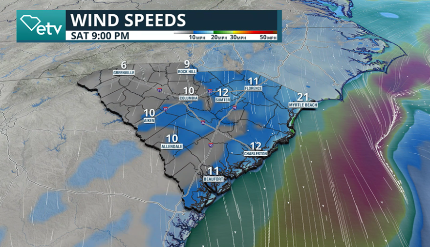
As the storm intensifies over the Atlantic, wind gusts along the immediate coastline are expected to peak between 30 and 40 mph, with gale-force conditions developing just offshore.
The worst conditions for the Palmetto State are expected to occur over the weekend, while the system makes its closest approach.

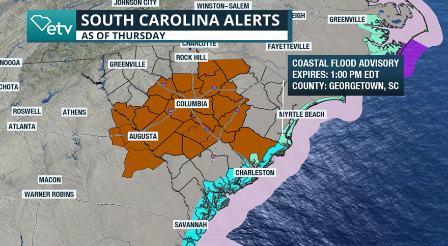
Local National Weather Service offices have issued Small Craft Advisories and Gale Warnings across coastal waters, urging mariners to alter plans and seek safe harbor until conditions improve.
Additionally, swimmers and surfers are also being urged to stay out of the water, with rough seas and an increased threat of rip currents.
Waves of 5 to 8 feet are forecast along area beaches, prompting a High Surf Advisory into the weekend.
Many beaches that are staffed by lifeguards use a color-coded flag system to indicate water conditions.
A single red flag means the surf is dangerous, while double red flags indicate that the water is closed to swimmers.
Lifeguards always caution residents and visitors to follow beach warning flags and avoid entering the surf when hazardous conditions persist.

Farther inland, the main impacts will include gusty winds and continued higher-than-normal tidal levels.
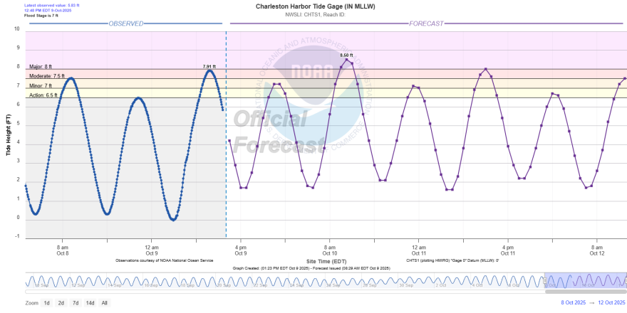
With the recent new moon and ongoing King Tides, water levels have already been running high across coastal South Carolina.
Earlier this week, water gauges reached at least minimal flood stage in several locations, with forecasts now calling for levels in the Charleston Harbor to reach major flood status on Friday.
The elevated tides will likely result in intermittent closures of low-lying roadways, especially around the Charleston Peninsula, where saltwater flooding frequently inundates streets during high tide cycles.
Emergency management officials remind drivers to avoid flooded roadways for not only for safety reasons, but also because saltwater can cause significant and costly damage to vehicles.

Looking Ahead
Conditions along the coast are expected to gradually improve late in the weekend as the offshore low begins to lift northward toward the northern mid-Atlantic. However, lingering rough seas and coastal flooding could persist into early next week before a ridge of high pressure settles in over the region.
The coastal storm is forecast to continue tracking northward along the Atlantic seaboard, bringing problems to the Northeast and New England by early next week.
After a cool, fall-like weekend, temperatures across the state are expected to slowly rise above normal values.
No significant cold fronts are expected to arrive during the next seven days, allowing for a gradual warming trend under mostly dry conditions.


