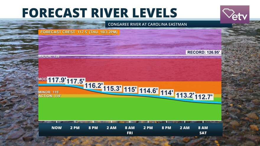
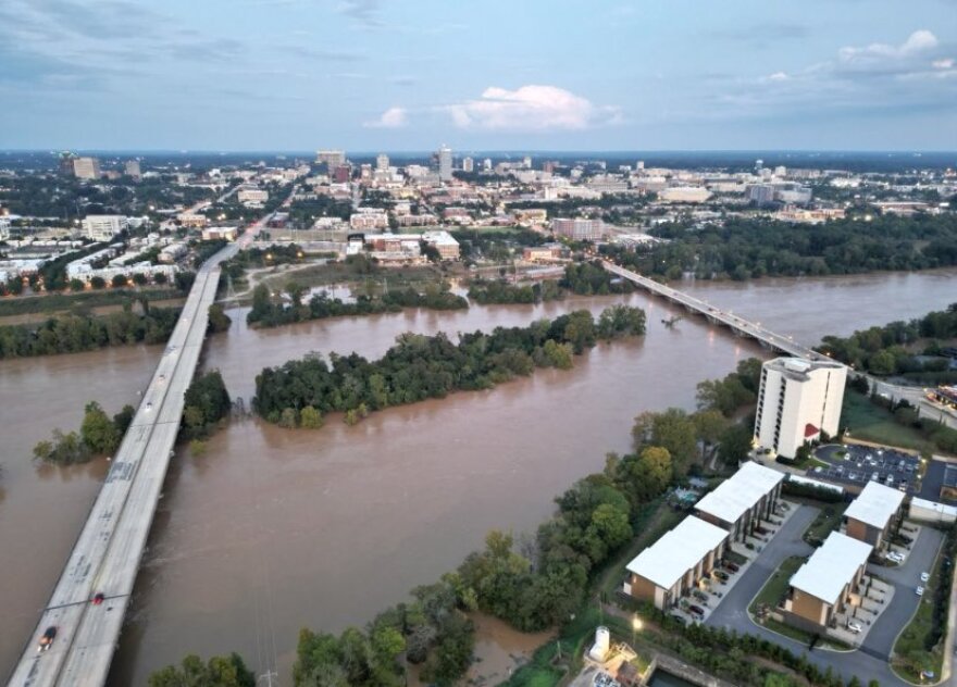
Parts of the Midlands and the PeeDee continue to experience river flooding in the aftermath of Hurricane Helene. And local law enforcement are asking people to continue to avoid the larger rivers in these areas, especially in and around the Columbia area including the Broad, Saluda and Congaree Rivers as water levels remain high.
RIVER FLOODING: Major flood stage will be reached Thursday near Jamestown as upstream flows move into the Lowcountry. While other basins should stay below flood stage, long-duration impacts are possible in flood-prone areas near the banks of the Santee River. #Helene #SCWX pic.twitter.com/8ooSxiT10z
— Meteorologist Dorien Minor (@MinorWX) October 2, 2024
The National Weather Service is also warning people who live north of Charleston of a flooding risk from the Santee River this weekend. The NWS says there is substantial flooding in the Santee River near Jamestown.

That would affect people around Bonneau and other parts of Berkeley County as well as portions of Georgetown and Charleston Counties as far away as McClellanville. It includes much of the Francis Marion National Forest.

The Santee River was at 21.4 feet early Thursday morning, according to the National Weather Service.. It is expected to crest at 23.8 feet early Saturday morning. At 24 feet, water could begin flooding nearby homes.
All rivers are slowly falling in our area. Across the State, only the Santee River is in major flood stage and still rising. It will crest Saturday. #scwx #ncwx pic.twitter.com/3yLbw8VGnn
— Ed Piotrowski (@EdPiotrowski) October 3, 2024
The last time we saw the river this high was during the historic flooding of 2015, when the Congaree River crested at 31.8 feet.

The Richland County Sheriff's Department says the waters in rivers near Columbia, Cayce and West Columbia are at some of the highest levels ever seen, according to officials.

Boat ramps into these rivers have been closed by the Sheriff’s office to try and keep everyone safe as we head into the weekend.
Important updates for those involved in #Helene recovery efforts: Find more information on temporary licensure for medical professionals, safety guidelines and resources to support the rebuilding process. Stay informed. https://t.co/7xMI5eAtUP#SCLLR #StaySafeSC
— SC Emergency Management Division (@SCEMD) October 2, 2024
The Federal Emergency Management Agency has a map of all flood zone designations that can be searched using this website; FEMA Website
There is also an instructional on the website for how to read the map. The most hazardous flood zones begin with the letters A and V, shown in the map below.
According to FEMA, just one inch of flooding can cause as much as $25,000 of damage to your home.


