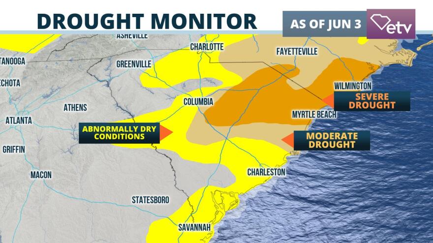
The spring dry spell focused on the eastern half of South Carolina is now officially causing "severe drought" conditions over a portion of the Pee Dee and Grand Strand.
NOAA's Drought Monitor released Thursday morning shows areas from southeastern Orangeburg county through Sumter and northeastward into the Florence, Conway, and Myrtle Beach areas are in the level D3 (severe drought) classification. The Drought Monitor is arranged on a scale from D0 (abnormally dry conditions) to D5 (exceptional drought conditions).
An abrupt but expected change in the weather pattern caused scattered to numerous storms to begin developing over the state on Wednesday. Some of the heaviest rain fell over areas experiencing the worst drought conditions. 2 to 5 inches fell over western Horry and nearby Marion and Dillon counties based on radar and rain gauges in the area. Similar amounts fell in portions of Berkeley, Darlington, Lee, and Sumter counties where drought or near drought conditions have developed in recent weeks.

The ground's inability to absorb heavy rain has, in turn, increased the chances for flash flooding. Flash Flood Watches are in effect over portions of eastern North Carolina, but there is also a risk of flash flooding from more thunderstorms over a portion of the Pee Dee and Grand Strand Thursday afternoon and evening. A few of the storms may produce localized pockets of wind damage, but this threat should be relatively confined compared to the flash flood potential.
Additional chances for mainly afternoon thunderstorms are forecast from Friday into the weekend, but it is too soon to say which areas, if any, will experience flooding or strong thunderstorms.


