A widespread rainfall event across South Carolina is on the horizon as an unsettled weather pattern continues into the first days of meteorological winter.
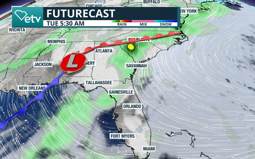
Forecast models show that after a weak cold boundary passes through on Monday, rainfall will begin to percolate around the state later in the day and into Tuesday as another frontal boundary moves generally from west to east.
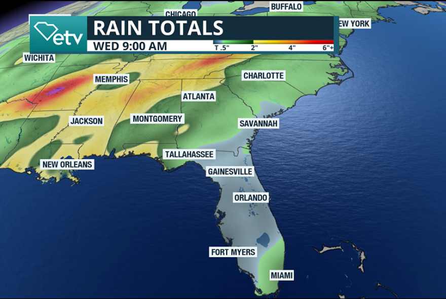
The combination of both events could result in widespread accumulations of 1-3 inches, with the bulk of the precipitation occurring on Tuesday morning.
The upcoming event promises to bring the most significant rainfall across South Carolina since before Halloween.
The lack of meaningful precipitation over the past month has allowed drought conditions to develop across the state.
Because of the ongoing abnormally dry soil moisture and manageable rainfall rates for drainage systems, flooding is not a concern during this go-around.

By Wednesday, rain chances will taper off for the entire state as a ridge of high pressure builds in behind the departing storm system.
The ridge will usher in a stretch of quieter weather, along with temperatures that will run slightly cooler than average for early December.
Most regions will see daytime highs in the 50s from Wednesday through Friday, but along the immediate coastline and including areas around Hilton Head, a few air temperature readings in the 60s will be possible.
Another wet weather system is expected to approach the region late in the week and extend into the weekend, bringing another round of widespread chances for rain.
Will there be any wintry precipitation?
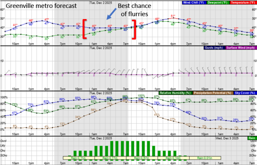
Temperatures for most areas will remain warm enough to keep precipitation in the form of rain, though this won’t preclude some higher elevations in the Upstate from seeing a brief period of freezing rain or a few snow flurries.
The best window for any frozen precipitation will be between midnight and sunrise on Tuesday, before temperatures begin their daily climb.

Any winter weather impacts will likely fall short of the criteria for a Winter Weather Advisory, and major population centers, such as Greenville, Columbia and Charleston, are expected to see only rain.
So far, no reporting stations across the Palmetto State have recorded measurable snowfall this season, though a few sites have reported a trace of wintry precipitation during November.


