Sunday marked the start of astronomical winter across the Northern Hemisphere, several weeks after meteorological winter began on Dec. 1.
Forecasters use meteorological seasons instead of the more common astronomical terms, as they more closely relate to temperature changes and make it easier to compare climate data year over year.
Astronomical seasons are based on the Earth’s position as it orbits the sun and the tilt of the planet’s axis.
The summer and winter solstices occur when the Northern Hemisphere is tilted at its maximum - either toward or away from the giant star.

During the winter solstice, the Northern Hemisphere is tilted farther away from the sun, resulting in many communities experiencing their shortest day of the year.
When Earth’s axis is not tilted toward or away from the sun, roughly at a 23.5-degree angle, the planet experiences what is known as an equinox.
The vernal equinox occurs in the spring, while the autumnal equinox takes place in the fall.
The exact dates of solstices and equinoxes vary slightly from year to year because the planet takes approximately 365.24 days to complete a full orbit around the sun.
The winter solstice also marks an important turning point: the gradual return of longer days.
While temperatures typically continue to drop for weeks or even months after the solstice, the amount of daylight begins to increase, albeit slightly at first.
In December and January, the gains are small - just seconds of daylight per day - but by March, daylight starts to increase rapidly, with several minutes added each day.

Cool start to meteorological winter so far
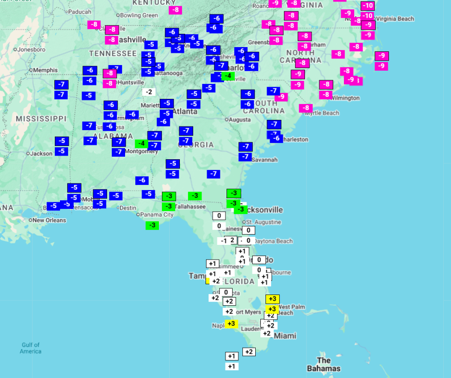
Through the first half of December, it has been a relatively cool start to the season, with temperatures running 5 to 10 degrees below typical values.
An Arctic spell helped plunge temperatures into the teens and twenties across much of the state just last weekend, and while the air mass did not break records, values were some 10-20 degrees off typical values.

If the season were to end today, it would rank among the top 20 coldest, but over three-fourths of the season remains, including what are usually the coldest weeks.
The Palmetto State is not alone, as much of the eastern half of the country has seen a snowier and colder start to the season, but a shift in the weather pattern is expected to reverse these cold anomalies.
An extended warm spell is forecast to send temperatures into the 60s and 70s for Christmas Day and beyond, which will erase many of those anomalies.


