

A storm system is expected to rapidly develop off the coast of the mid-Atlantic and intensify into the bomb cyclone but before it does so it will lay a path of heavy snow gusty winds across South Carolina.
The ingredients are coming together for a widespread snowfall event, with many locations picking up 2 to 4 inches across the state and totals in excess of 4 inches along the South Carolina–North Carolina border.
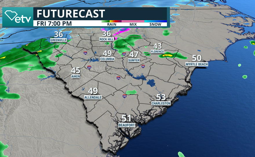
Precipitation is expected to begin Friday evening and will initially fall as rain or a rain-snow mix.
As colder air quickly moves into the state overnight, precipitation is expected to transition to all snow, with temperatures dropping low enough to support dry, fluffy snowfall rather than ice.
The upcoming storm system will differ significantly from last weekend’s event, which produced a substantial ice threat across parts of the Upstate and the Midlands.
The primary window for the heaviest snowfall is expected between sunrise and sunset Saturday.

While the exact placement of developing snow bands will remain unknown until the event takes place, periods of moderate to heavy snow could quickly reduce visibility and create hazardous travel conditions.
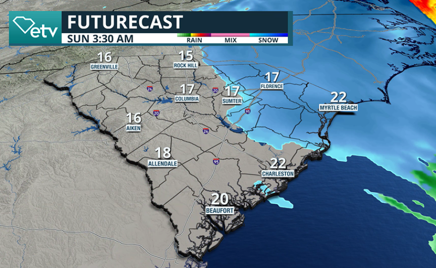
Frozen precipitation is expected to end early Sunday as the storm pulls away from the coast.
As the surface low strengthens offshore, it is expected to undergo bombogenesis - a rapid intensification process defined by a drop in central pressure of at least 24 millibars within 24 hours.
The tightening pressure gradient around the storm will lead to gusty winds across both coastal and inland areas.
Forecast models indicate widespread wind gusts of 30 to 40 mph, with locally higher gusts possible, especially on Sunday.
If stronger wind gusts coincide with falling snow, conditions could approach blizzard-like criteria in some locations.
A blizzard features frequent wind gusts of 35 mph or greater, combined with falling or blowing snow that reduces visibility to one-quarter mile or less for an extended period.

Behind the storm system, a surge of Arctic air is expected to settle across South Carolina and much of the eastern United States.
Low temperatures by Sunday morning are forecast to fall into the teens across much of the state, with wind chill values dropping to around 0 degrees in some areas.
Cold weather is expected to persist into the middle of next week, with overnight lows generally in the teens and 20s and daytime highs struggling to reach the 30s and 40s.
The prolonged cold weather event poses risks to poorly insulated pipes, as well as people and pets without reliable access to heat.
In structures with exposed pipes, local emergency managers suggest letting an indoor faucet drip to help prevent pipes from cracking and bursting.
For those without access to heat, officials recommend helping them find the nearest warming center.
Additional warnings that will likely to be issued during the event include a Winter Storm Warning, indicating that travel may be impacted by snowfall, and an Extreme Cold Warning, which is issued ahead of the presence of dangerously cold air.
