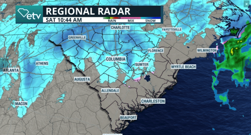
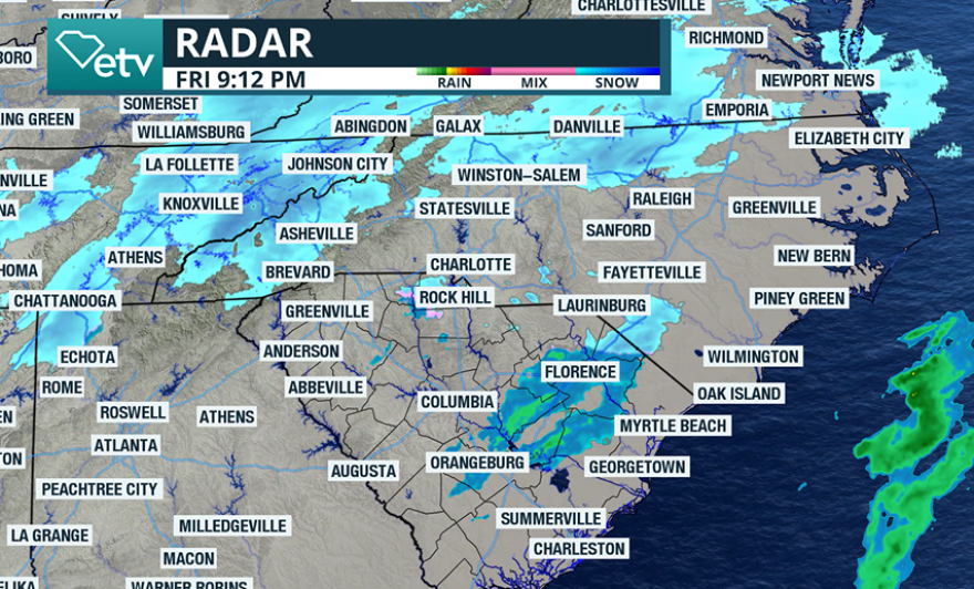
A winter storm is producing heavy snowfall and ushering in dangerously cold air across the mid-Atlantic in what could be the most significant system in more than a decade.
All of South Carolina’s 46 counties are under a Winter Storm Warning and an Extreme Cold Warning, which are in place because of the expected precipitation and dangerously cold temperatures.
Forecast models show widespread totals of 2 to 4 inches, with higher amounts, especially north of Interstate 26 and along the South Carolina–North Carolina border.
The greatest accumulations are expected in the region from Spartanburg through Rock Hill and over to Myrtle Beach. Some locales in this vicinity could approach double-digit snowfall totals.

All of the precipitation is forecast to move offshore by sunrise Sunday, leaving behind an Arctic air mass in its wake.
Temperatures during the second half of the weekend are expected to drop as low as 10 degrees across the Upstate, with wind chill values feeling closer to zero.
Forecasts indicate that prolonged exposure to such cold conditions can cause frostbite and hypothermia within minutes.
Temperatures are expected to remain below average through the week, with melting snow potentially causing ice on untreated roadways in the morning.

As the main surface low strengthens offshore, it is expected to undergo bombogenesis - a rapid intensification process when the central pressure drops at least 24 millibars within 24 hours.
The storm system will have a strength similar to a hurricane, so boaters are advised to remain in port until offshore conditions improve.
See the latest coverage on the winter storm in the live blog below.
Happening now:
The snowfall is wrapping up in Greenville, but it will last for several more hours across the Grand Strand.
So far the greatest totals are outside of Greenville and near Rock Hill where between 7-8" fell.
The intrusion of dry air on the western edge of the developing winter storm helped to cut down on some snow totals versus what some models depicted.
All of the precipitation will be offshore by sunrise on Sunday morning.

Previous updates:
Saturday, 3:30 p.m.
Snowfall totals in the Upstate have reached between 5-6" around Greenville, while Columbia has seen 1-3" of snow.
There are several hours of snowfall to go, and South Carolina troopers are encouraging everyone to stay at home if possible.
The heaviest snow for communities such as Florence and Myrtle Beach is still ahead.

Previous updates:
Saturday, 1:00 p.m.
Saturday, 10:30 a.m.
Roads Upstate get dangerous as heavy snow falls.
Snow will continue to fill the radar images through out the day, intensifying across the Midlands and the coastal region.

Saturday, 9:30 a.m.
While the entire Palmetto State is under a winter storm warning, meaning heavy snow will fall along with gusty winds, the National Weather Service in Charleston, South Carolina, is also looking at the chance of expanding the warning into Savannah, Georgia, which is a region our Charleston, SC, office also covers.
"Heavy snow" can mean different amounts to different regions. One to two inches might not seem like a lot in Chicago, but for southern regions, this can cause major disruptions and roads can turn dangerous.

Saturday, 8:15 a.m.
Snowfall started on Saturday morning in Columbia, South Carolina. We forecast that snow will continue to fall, with intensity increasing over the next few hours. The highest impacts will be late this morning through the afternoon. 6 to 9 inches are expected through the day in the Columbia area. Please avoid traveling, winds will be strong, and roads will be dangerous.
Snow showers are falling across the forecast area this morning and will increase in intensity and coverage as the day goes on. Here is a briefing outlining the various threats associated with today's snowstorm. #CAEWx #SCWx #GAWx https://t.co/cv13UtGA30
— NWS Columbia (@NWSColumbia) January 31, 2026
Friday, 11:15 p.m.
South Carolina Department of Transportation crews are working around the clock to pretreat roadways. DOT officials say they have hundreds of personnel working to maintain approximately 41,000 miles of roadways.
Conditions are expected to deteriorate first along Interstate 85, followed by Interstate 20 around the lunch hour and later in the evening along Interstate 95.
Officials are urging residents to stay home on Saturday to allow crews the room they need to respond to issues.
“Unlike last weekend, there’s no threat of deadly ice damage and extended power outages – just slushy snow on roads and bridges that could freeze overnight. Stay off the roads unless absolutely necessary. As a precaution, last Wednesday’s state of emergency has remained in effect for this weekend," Governor Henry McMaster said in a statement.
You can check out road conditions and traffic updates at: https://www.scdot.org/travel/travel-road.html
#WinterStormGianna is expected to bring snow accumulation over most of the state, creating hazardous driving conditions.
— SCDOT (@SCDOTPress) January 30, 2026
If possible, stay off the roads completely. If you must drive, slow down and give our crews plenty of room to work. pic.twitter.com/6hK6eNEMv3
Friday, 9:15 p.m.
The initial round of flurries has begun moving into the Upstate.
The flurries are expected to remain light through the evening hours, with no accumulations before midnight.
Snowfall rates are expected to increase between sunrise Saturday and sunrise Sunday.
Based on forecast models, many weather observation sites in South Carolina are not expected to challenge their all-time snowfall records, but the storm system has the potential to rank among the top 10 snowfall events for some locales.


