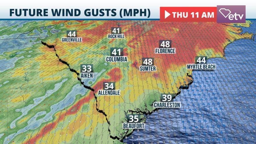
Rapidly-moving Tropical Storm Zeta has been producing wind gusts to tropical storm force across a large portion of the Upstate and even parts of the Midlands Thursday morning. Peak wind gusts to 54 mph were reported at Greenville/Spartanburg, 59 mph at Anderson, and 44 mph at Clemson. The WeatherSTEM station at Williams-Bryce Stadium in Columbia reported a gust to 39 mph as of mid-morning.
Tropical Storm Warnings continued over the Upstate for the likelihood of gusts exceeding 50 mph. These winds are forecast to gradually subside this afternoon. Wind Advisories continue until 6 PM Thursday over the Pee Dee and Midlands for occasional gusts to 45 mph.

After Zeta moves toward the Mid Atlantic states, a strong cold front will approach from the west late Thursday afternoon and evening. High humidity, unstable air, and strong wind shear may produce additional gusty winds from scattered showers or thunderstorms mainly after 3 PM. The greatest chance of these conditions is roughly on a line from the Aiken area to Columbia to Rock Hill and eastward to Interstate 95. An isolated tornado or two is possible from these scattered storms, but the ingredients for tornadoes are not perfectly lined up. As a result, the overall tornado threat is low.
The cold front is forecast to move offshore around midnight, effectively putting an end to the stormy weather conditions late tonight. Cooler, drier, and windy conditions are likely behind the front on Friday.


