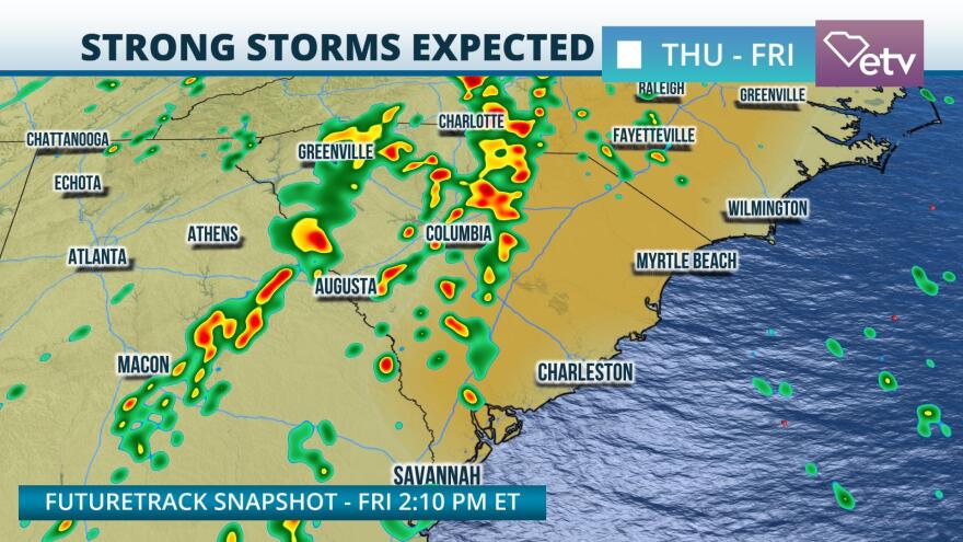
Strong and severe thunderstorms could sweep through South Carolina Thursday into Friday as a cold front moves across the state.
Surface observations Wednesday afternoon indicate an area of low pressure anchored over the Central and Southern Plains, with a cold front draped across Central and South Texas. A warm front north of the Ohio River Valley has ushered dew point temperatures into the 60s as far north as Chicago, Illinois. This will set the stage for severe weather across the Mississippi River Valley and Great Lakes region Wednesday afternoon and evening. By Thursday, increasingly warm and unstable air will result in thunderstorm development for portions of the Palmetto State.
Model guidance suggests that the Upstate will be visited first with the risk for strong thunderstorms Thursday afternoon. There is some uncertainty regarding how far into the Midlands this initial round of activity gets. The most reliable guidance keeps the risk for severe weather mainly along and west of I-77 through Thursday evening. However, thunderstorms are expected to redevelop Friday as a warm and unstable atmosphere again supports the risk of damaging winds and large hail. Storms could develop as early as Friday afternoon near the Columbia area before pushing north and east. By Friday night, the strong thunderstorm risk should diminish as the cold front pushes offshore of the Palmetto State.
The Storm Prediction Center has the Upstate and western Midlands under a "marginal" risk for severe weather Thursday, which is a 1 on a 1-to-5 scale. By Friday, the risk area will push east into the Midlands, Lowcountry, and Pee Dee. In these areas, a "marginal" to "slight" risk for severe weather is likely, which is a 1 and 2 respectively on the 1-to-5 scale. The atmosphere is likely to support a damaging wind risk, however, the strongest cells could also produce large hail. Enough low-level spin could exist in the atmosphere to support an isolated tornado threat, especially for the Upstate, northern Midlands, and Pee Dee Thursday into Friday. On top of the risk for severe weather, the slow-moving nature of storms could result in localized flash flooding. Thursday brings the most substantial risk for flash flooding to the higher elevations of the Upstate. The risk for excessive rainfall will slide east into Friday, potentially impacting locations along and east of I-77.


