

Meteorological winter officially came to an end Saturday across North America, and based on preliminary observations, the season produced a mixed bag of patterns across the United States. While the country as a whole experienced a warmer-than-average winter, portions of the eastern half of the nation, including South Carolina, finished the season cooler than normal.
Data compiled by the Southeast Regional Climate Center indicates that most observation sites across the Palmetto State recorded the medium temperature ranging from near normal to roughly three degrees below average during the three-month period that started in December and ran through February.
In addition to cooler weather, precipitation totals also lagged behind seasonal norms across much of the state.
Many reporting stations finished the season several inches of rainfall below normal values, continuing a trend that has persisted for more than a year across parts of the region.
Within the state, the Florence area stood out as one of the colder locations during the season.
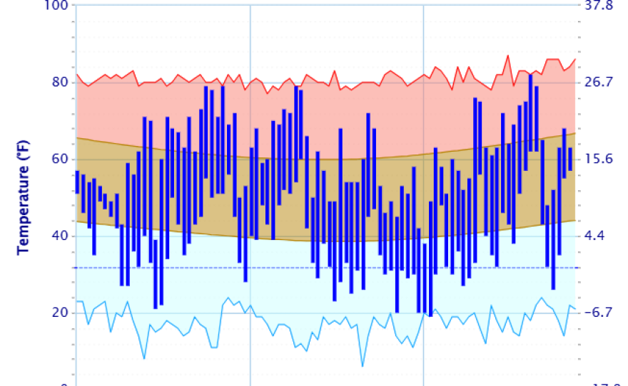
Data showed that the Pee Dee region experienced its 19th coldest meteorological winter in 78 years of observations, finishing with an average temperature of around 45 degrees.

During a flurry of winter storms in January, temperatures dropped to around 10 degrees Fahrenheit in some communities in the higher elevations as Arctic air spread across the Southeast.
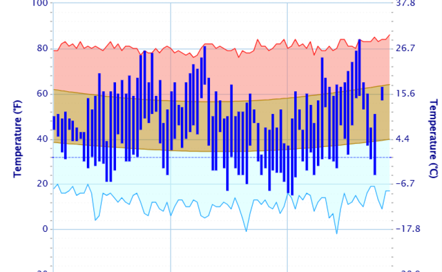
Despite the cooler weather, warm spells were still noteworthy features during the winter months.
The number of daily record highs across South Carolina far exceeded the number of record lows, with notable warm periods in late December, mid-January and late February.
The cold weather season also featured two impactful winter storms with frozen precipitation.
A mid-January ice storm produced some of the most hazardous travel conditions of the season.
Pockets of freezing rain accumulated to more than one-half inch in localized areas, leading to scattered power disruptions, especially across the Upstate.
Later in the month, another winter storm produced widespread snowfall, with some locations receiving upward of a foot of snow.
Accumulations varied considerably across neighborhoods, with lighter-impacted areas recording only around an inch of snowfall.
Although all major observation sites exceeded their typical seasonal frozen precipitation totals - in many cases for the second consecutive winter - snow contains less liquid water content than a heavy rainstorm, meaning that it is less beneficial for the drought status.
As a result of the lack of soil moisture, drought conditions across South Carolina have remained rather stubborn since the beginning of last year.
In some areas, the intensity of the drought has increased despite the presence of the winter storms.
Spring looks to make up for any cold temperature anomalies
According to NOAA’s latest outlook for meteorological spring, which runs through May, much of the southern tier of the United States is expected to experience above-average temperatures, with precipitation totals ranging from near to below typical values.
Complicating seasonal weather forecasts is the anticipated weakening of La Niña conditions toward a more neutral phase of the El Niño–Southern Oscillation.
Neutral ENSO conditions typically promote a more zonal, west-to-east flow across the country, which can limit weather extremes compared to stronger El Niño or La Niña patterns.

Forecasting during this time of year is more challenging due to what meteorologists refer to as the spring predictability barrier in the Pacific.
During the spring months, computer models often struggle to accurately project changes in ocean heat patterns across the tropical Pacific.
In some years, seasonal outlooks predict that the world will transition out of La Niña earlier than what actually occurs, leading to potential errors in long-range climate forecasts.