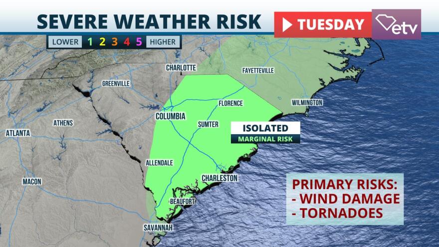
A strong early fall cold front is expected to sweep through South Carolina Tuesday, triggering a line of strong storms ahead of it and ushering in a much cooler air mass in its wake.
Clusters of thunderstorms are expected to develop ahead of the front across the Upstate region by early afternoon Tuesday. The storms are then forecast to congeal into a line or two of stronger cells in the Midlands region by late afternoon, or by early evening across the coastal plain of South Carolina. However, there is some forecast uncertainty on how soon this may occur and when the line would reach peak intensity.
As of Monday afternoon, the National Weather Service Storm Prediction Center had placed the eastern two-thirds of South Carolina under a "marginal" (level 1 out of 5) risk for severe thunderstorms Tuesday afternoon and evening. Based on the projected atmospheric profile at the time, the primary hazard from the strongest storms would be damaging wind gusts up to 60 mph, although a tornado can not be ruled out.
A much cooler and drier air mass will follow the front, and below-normal temperatures are expected statewide starting Wednesday and lasting through at least Friday. Afternoon highs will generally be in the 70s, and overnight lows in most areas will fall into the 50s. Even locations near the coast might briefly dip below 60 degrees Thursday and Friday morning.


