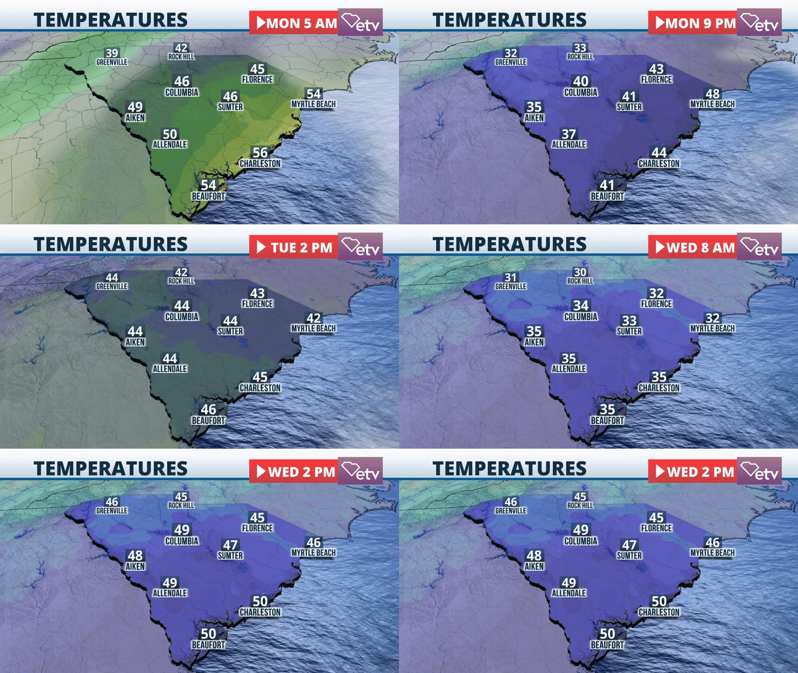
A significant winter storm is moving through South Carolina, bringing some heavy showers through Monday afternoon. Upstate counties, especially those in higher elevations, could receive ice accretion and a few flakes.

The same system that has wreaked havoc across the Central Plains and will continue to bring plenty of snow across the Mid-Atlantic states will push eastward. For South Carolina, we’re not expecting widespread snow, but we are expecting a healthy amount of rain that will move from west to east, and it is expected to exit the coast before sunset on Monday. Overall, rain totals will be between a quarter to one inch, with the possibility of some ice accretions over the northern counties of Upstate, such as Greenville and Pickens. In addition to ice building, the strong winds could bring some trees and powerlines down, creating power outages.

The wind will stay strong, mainly from the north. Several lake wind advisories will stay put at least through Tuesday morning. A widespread wind advisory is in effect for much of the Midlands, parts of the Pee Dee, and the Lowcountry. Some gusts could reach 45 mph on Monday as the system exits just to the north of us. On Monday night, its front drags and emerges over the Atlantic.

On Tuesday, the coldest weather will affect Upstate, the Midlands, Lowcountry, and the Pee Dee. Temperatures in the morning will be very cold. Across Upstate, temperatures will be between the low to mid-20s, while the coastal areas will be just below freezing. There won’t be much relief on Tuesday afternoon as the temperatures will stay around the mid-40s statewide. But remember, there could still be strong winds that will make the temperatures feel much colder. The winds could still reach 20 to 25 mph, mainly from the north.

The skies will be clearing, and by Tuesday, we expect lots of sunshine with a high-pressure system starting to move in from the west. We forecast quiet weather for the rest of the week, with a weak cold front pushing through South Carolina on Wednesday morning. This midweek cold front is not expected to bring showers but will reinforce the cold air across much of the state. The next series of cold fronts will push through the Palmetto State on Saturday, where, once again, we’ll have a chance for rains and perhaps a snow shower over the mountains.


