

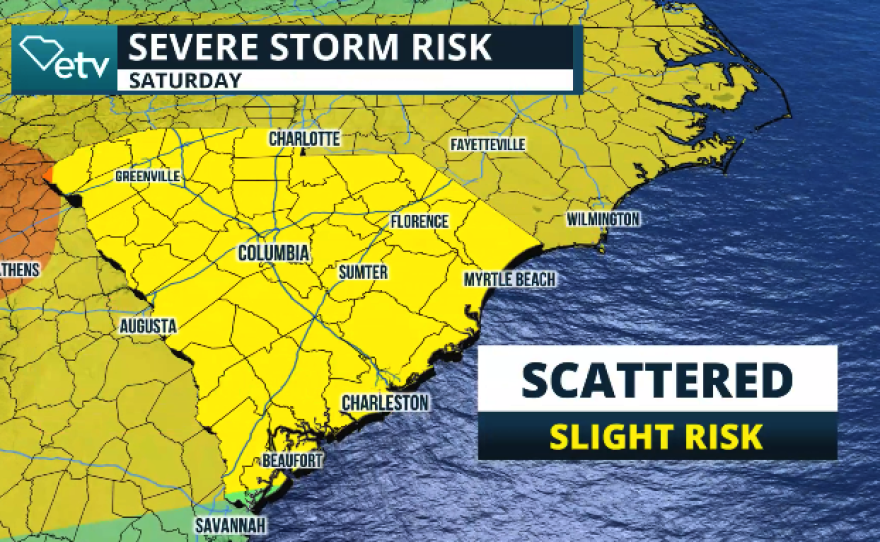
An extensive cold front will continue to inch closer to the Southeast this weekend. There is a chance for severe thunderstorms to occur across South Carolina through the beginning of the week. Overall, there’s a slight risk for severe storms for Saturday through Monday, but more activity is probable beyond the start of the week.
Saturday evening:
A severe thunderstorm watch is in effect for the Upstate. It will be valid until 9 p.m. Saturday, as severe thunderstorms will push from east to west. The biggest threat of severe thunderstorms is damaging winds, gusts, and hail, but we cannot rule out an isolated tornado.


Sunday:
Strong to severe thunderstorms will start in the morning and continue into the afternoon across the Upstate. During the afternoon, storms should move across the Midlands and eventually over the Pee Dee into the early evening hours on Sunday. Damaging winds and hail will continue to be the main risks with any severe storms that develop.
Monday:
Strong to severe thunderstorms will once again be possible on Monday. The main risk will be across the Midlands through the Lowcountry and Pee Dee, but by the evening, some strong to severe thunderstorms could develop again across the upstate.


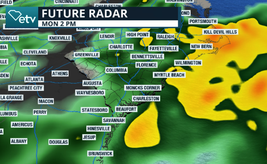
As the cold front becomes stationary over the Midlands on Monday, the constant flow from the southwest will continue to bring a stream of moisture from the Gulf. This is ahead of the next frontal boundary, which will continue to push eastward and over South Carolina on Wednesday. But by Thursday, expect this same cold front to become stationary. Therefore, the chance for showers and thunderstorms will likely continue throughout the week.