

Strong to severe storms have been a constant for several days, including the weekend, across many parts of South Carolina. The culprit is a series of cold fronts that have all lost their speed, becoming stationary, and meander around close enough to bring instability. Combined with the instability, plenty of moisture is still pumping in from the Gulf, feeding the storm development and keeping the atmosphere muggy and warm.
On Monday, there were over 50 reports of damaging winds, and a tornado was reported about 30 miles northwest of Columbia near Chapin in Lexington County. It happened shortly before 9 p.m., and many residents reported lights flickering. The tornado could have had maximum peak winds of 95 mph, making it an EF-1. It is estimated that it traveled over 6 miles and had a width of 200 yards, leaving several trees and power lines down.
Took this last night at 8:51 PM looking north across Lighthouse Marina cove. pic.twitter.com/FbwZAxM76n
— Kevin (@kpkandalaft) June 10, 2025
This is the 7th confirmed tornado within our area in 2025 and the second in Lexington County.NWS Columbia
Forecast for the coming days
Wednesday will be a transitional day with some isolated thunderstorms confined to the Lowcountry, Pee Dee, and some over the eastern Midlands.
A stationary front will keep most showers and isolated storm activity over I-20 and eastward. At the same time, the Upstate and the western Midlands will stay under partly sunny skies, and a few showers in the morning.

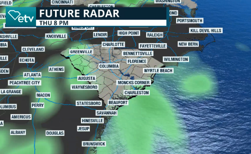
Thursday and Friday promise to be more active across most of the state. The stationary front will fizzle out, but another front, a warm one, will bring the instability. Showers and storms are forecast to start the day on Thursday across the eastern half, then become scattered statewide in the afternoon. By evening, a few storms will likely affect Augusta, Ga., Columbia, Florence, and the surrounding areas. Storms will move from southwest to northeast, developing multiple lightning strikes. There is no identified risk for organized severe storms, but remember that some isolated storms could be strong to severe.


The weekend in South Carolina seems to stay with the southwest humid flow, so there will be a chance for thunderstorms, mainly in the afternoon and early evenings.