

The National Hurricane Center officially named Depression 3 as Tropical Storm Chantal on Saturday morning. The storm is moving to the north at 1 mph and has maximum sustained winds of 40 mph. A new track will be released at 5 p.m.

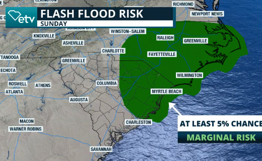
The winds will be increasing throughout the afternoon and evening hours as Chantal inches closer to the coast of South Carolina. The latest track puts Chantal just south of Georgetown at 8 a.m. Sunday. The rains will arrive before the storm makes landfall. There will be periods of heavy rains affecting the Pee Dee through North Carolina on Saturday through Sunday night as the storm moves inland. The flash flood risk will continue through Monday for the Carolinas.
TS Chantal is crawling toward South Carolina. The winds are expected to increase throughout the day, with strong coastal gusts. TS winds extend outward up to 90 miles, mainly to the east of the center. pic.twitter.com/lfgIgQVilG
— SCETV (@SCETV) July 5, 2025
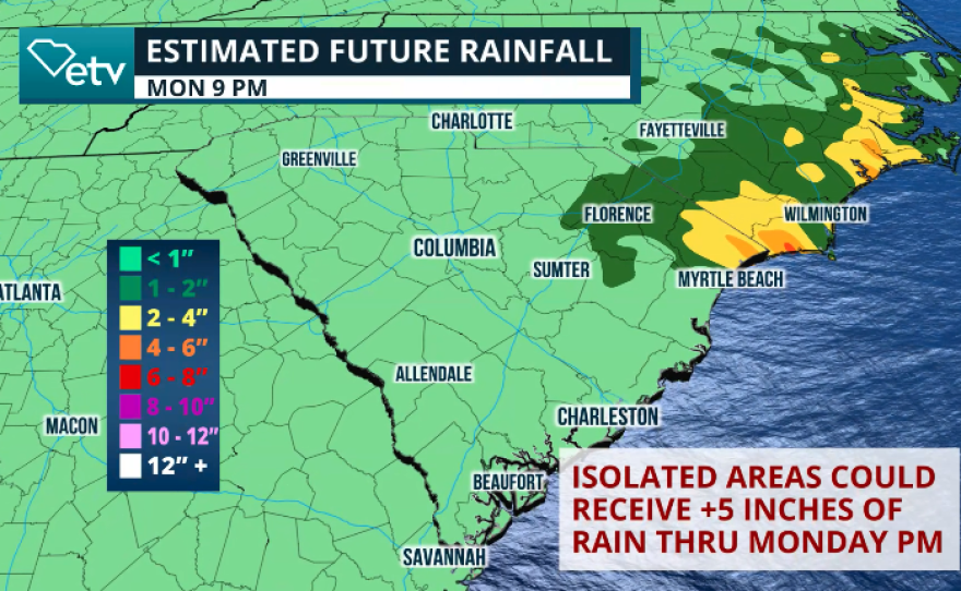
Forecast models indicate that the highest rainfall will remain mostly confined to the northern coastal areas of South Carolina and North Carolina, where 2 to 4 inches of rain are expected to fall. However, some isolated spots may receive over 6 inches of rain through Sunday. Please watch out for flooding. Avoid crossing flooded roads, as the water may be deeper than expected.
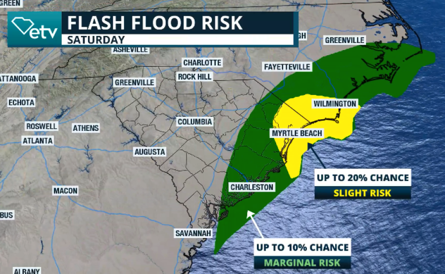
Chantal will bring periods of heavy rains across the coastal plains of the Carolinas. Flash flood risk will be present through early next week. For South Carolina, the threat will be mainly today through tomorrow morning. Portions of the Pee Dee up to 5'' of rain are possible. pic.twitter.com/Sq8mgyG6wU
— SCETV (@SCETV) July 5, 2025
Marine hazards
Swimmers are asked to please stay out of the water, as there is a high risk of rip currents through Saturday evening across the coastal areas of South Carolina. Seas will also be rough, so boaters are expected to stay off the water.
We will continue to monitor the situation closely and provide you with updates promptly.